Stocking Up Your Library — More Books Added!
Olive Tree Account
Log in
Can't Log In?
New to Olive Tree?
Olive Tree Account
Forgot Password
Enter the email address associated with your Olive Tree account to reset your password
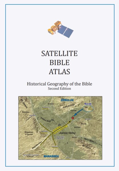
Satellite Bible Atlas
Our Price:
$49.99
Gift Price:
$49.99
Available for:
iPad, iPhone, Android, Mac, and Windows.
Features
Click on a feature to learn more.
The Resource Guide is the most powerful feature in the Olive Tree Bible App. As you read your Bible in the main window, the Resource Guide follows along and displays relevant Bible study information from your study notes, commentaries, maps and more.
Wondering where that ancient Israelite city is located that you just read about? Check out the map the Resource Guide will find for you, zooming-in or making it full-screen - or both.
Learn more with information displayed in visually-appealing ways. Not sure what charts you have? The Resource Guide will automatically pull up charts from any relevant sources while you're studying.
Reading about a person, place, or thing but don't know what it looks like? If this book has an image of what you're looking for, the Resource Guide will let you know. Just glance under "Image," and tap to see the photo enlarged.
Did your resource mention a passage of Scripture, but you can't remember what the verse says? Never fear! Tap the linked verse and a pop-up window will appear, giving you quick and easy access to the verse in context.
Satellite Bible Atlas
For the Olive Tree Bible App
Publisher: Schlegel, William
Satellite Bible Atlas
For the Olive Tree Bible App
Publisher: Schlegel, William
Our Price:
$49.99
Gift Price:
$49.99
Available for:
iPad, iPhone, Android, Mac, and Windows.
Features
Click on a feature to learn more.
The Resource Guide is the most powerful feature in the Olive Tree Bible App. As you read your Bible in the main window, the Resource Guide follows along and displays relevant Bible study information from your study notes, commentaries, maps and more.
Wondering where that ancient Israelite city is located that you just read about? Check out the map the Resource Guide will find for you, zooming-in or making it full-screen - or both.
Learn more with information displayed in visually-appealing ways. Not sure what charts you have? The Resource Guide will automatically pull up charts from any relevant sources while you're studying.
Reading about a person, place, or thing but don't know what it looks like? If this book has an image of what you're looking for, the Resource Guide will let you know. Just glance under "Image," and tap to see the photo enlarged.
Did your resource mention a passage of Scripture, but you can't remember what the verse says? Never fear! Tap the linked verse and a pop-up window will appear, giving you quick and easy access to the verse in context.
Description

This stunning Bible atlas contains 85 full-page color maps. It is the perfect companion to your Bible study with biblical events clearly marked on enhanced satellite imagery, and accompanied by geographical and historical commentary to give you the context you need.

Video: How Bible Maps work in the Olive Tree Bible App

Reviews

“The Satellite Bible Atlas is characterized first and foremost by beautiful satellite imagery and detailed historical markings. No other atlas features so many large maps with nearly every biblical event in Israel depicted with precise detail. Each map is accompanied by commentary that draws out the geographical significance of the history to bring the story alive to the reader. As one who has taught college and seminary students in Israel for 25 years, Bill Schlegel understands and communicates God’s revelation to his people in his land in a way like few others. The Satellite Bible Atlas deserves to be the Israel field guide for the next generation of students, young and old. The atlas is also ideal for students in introductory Bible classes.” - Todd Bolen, creator of the Pictorial Library of Bible Lands, Professor of Biblical Studies, The Master’s University

“This is a must-have. Our students use this atlas in our Israel travel/study program. The precision of satellite photography overlaid with clearly demarcated boundary lines and biblical historical graphics—the whole topped off by text commentary—has resulted in this beautiful and useful historical atlas of Bible lands.” - Eugene H. Merrill, Distinguished Professor of Old Testament Studies, Dallas Theological Seminary

“A delightful and dependable compendium of historical facts and insights. The work is thoroughly researched, punctuated throughout by helpful synchronisms with extra-biblical records, meaningfully interactive with competing opinions, and thoughtfully committed to the factual inerrancy of the Scriptural record. The map markings are remarkably helpful, and the fact that those markings are not superimposed upon a drawn map but upon cartographically-enhanced satellite photographs of the terrain adds a healthy level of reality to the work. Very much worth a focused read-through, and then perpetually valuable as a study resource no matter where the student is in the Scriptures.” - Doug Bookman, Professor of New Testament, Shepherds Theological Seminary

“I own sixteen separate Bible Atlases, and I can say unequivocally Bill Schlegel’s Satellite Bible Atlas is the one I recommend. It is a gateway to some absolutely dynamic Bible study; it is theologically sound and Biblically conservative. I pray that God will use this book in your life as he has in mine.” - Richard Rigsby, Professor Emeritus of Old Testament and Former Director of Talbot Bible Lands Program, Talbot School of Theology


Bill Schlegel lives with his wife and family near Jerusalem.
Our Price:
$49.99
Gift Price:
$49.99
Available for:
iPad, iPhone, Android, Mac, and Windows.
You might also like…